Ventoux
bybike

From Bédoin

Bédoin is the starting point of the most famous climb up the Giant of Provence, the one the Tour de France uses. Here is how to prepare for it, and why the Cabanon, 3 km from the start, makes a good base.

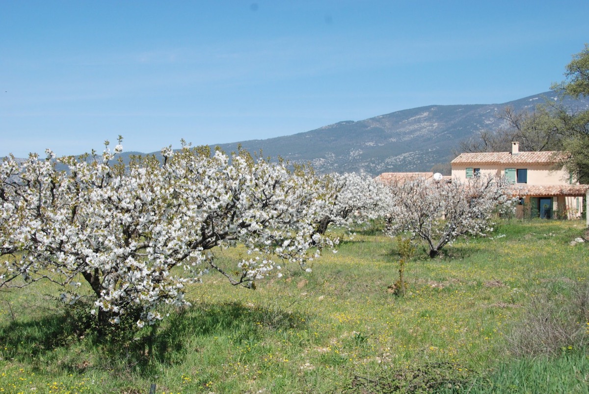
Mont Ventoux seen from the Cabanon, behind the cherry trees in blossom

The climb,
in three parts

Three landscapes in a row: vineyards, forest, then the desert of white stones you can see from all over Provence.

  1. Km 0 to 6

    Bédoin – Saint-Estève

    A warm-up through vineyards and cherry orchards at 4 to 5%. Save your legs: the Saint-Estève bend is where the real climb begins.

  2. Km 6 to 16

    The forest

    The heart of the climb: around ten kilometres at about 9%, with no real let-up, shaded by the trees. It ends at Chalet Reynard, at about 1,420 m, a good place for a break.

  3. Km 16 to 21

    The stone desert

    The last six kilometres have no trees at all, so you are exposed to sun and wind. You pass the Tom Simpson memorial just over a kilometre from the top, then reach the observatory and its red and white mast.

Our
tips

In summer, you prepare as much for the heat at the bottom as for the cold at the top.

Set off early, for the sunrise

Sunrise from the summit is an incredible sight, with daybreak spreading across the whole of Provence. To catch it, leave before dawn with good lights. Even without it, an early start means a cooler climb on a quieter road.
Pack a windproof

The summit is often 10 to 15 °C colder than Bédoin, and the mistral can blow hard up there. The descent is cold, even in midsummer.

Eat and drink

Leave with two full bottles. Chalet Reynard, two-thirds of the way up, is the place to rest and refuel.

Hire a bike

Bédoin has several shops hiring road bikes and e-bikes, 3 km from the Cabanon. Book ahead in high season.

The other
routes up

Once you have Bédoin in your legs, two more roads lead to the summit, both easy to reach from the house.

From Malaucène

The north side, roughly as long and as hard as Bédoin, with some steeper sections. Malaucène is reached by the road that skirts the massif to the west.

From Sault

The gentlest climb, and the longest (about 26 km), through lavender fields in early summer. It joins the Bédoin road at Chalet Reynard.

The Cinglés du Ventoux

The challenge for the most determined: all three routes in a single day. The Club des Cinglés du Mont Ventoux awards a certificate to those who make it.

And afterwards,
the pool.

The Cabanon des Cerises is a Provençal farmhouse for 8 guests, 3 km from Bédoin village and the foot of the climb. We let it in June, July and August.

Check availability →
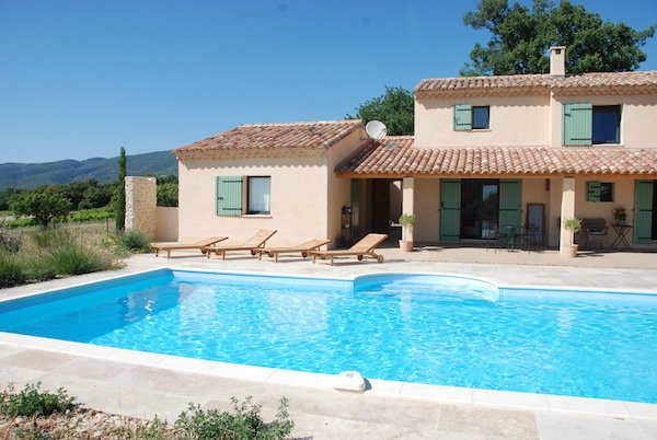
The heated pool in front of the farmhouse

Recover

A 10 × 5 m pool heated to 28 °C, with sun loungers in the shade of the veranda.

Refuel

Summer kitchen, barbecue and a table for 10 on the terrace, facing the Dentelles de Montmirail.

Common
questions

What guests most often ask us before riding up. For anything else, drop us a line.

  • How long does the climb take?

    Tour de France riders do it in under an hour. A fit cyclist should allow an hour and a half to two and a half hours, often more the first time. It is not a race: what matters is reaching the top.

  • Is the summit road open in summer?

    Yes. The road above Chalet Reynard closes in winter, but it is open from late spring to autumn, so throughout the season when we let the Cabanon.

  • Can I ride up on an e-bike?

    Yes, and it is a good way to discover the climb without being a serious athlete. Just check the battery range with the hire shop: 1,600 m of climbing is a lot.

  • Are there easier rides around Bédoin?

    Yes. The quiet lanes linking Bédoin, Crillon-le-Brave, Caromb and Mazan wind through vineyards and orchards without any big climbs, past several villages worth a stop. For the rest of the day, see our favourite places.

See you this summer?